geotechnical engineering
❌ Not A Career profession189
daily views
138,041 total
Geotechnical engineering, also known as geotechnics, is the branch of civil engineering concerned with the engineering behavior of earth materials. It uses the principles of soil mechanics and rock mechanics to solve its engineering problems. It also relies on knowledge of geology, hydrology, geophysics, and other related sciences.
Geotechnical engineering has applications in military engineering, mining engineering, petroleum engineering, coastal engineering, and offshore construction. The fields of geotechnical engineering and engineering geology have overlapping knowledge areas. However, while geotechnical engineering is a specialty of civil engineering, engineering geology is a specialty of geology.
Current Images

Main article image
Boston CAT Project-construction view from air.jpeg
View of Boston's Big Dig from the air. This view is looking from Boston over the Charles river. The...
View of Boston's Big Dig from the air. This view is looking from Boston over the Charles river. The...
Computational engineering icon 2.png
Computational engineering icon
Computational engineering icon

Cone penetration test.svg
The symbol of the cone penetration test method, shown in planar drawings relating to geotechnical in...
The symbol of the cone penetration test method, shown in planar drawings relating to geotechnical in...

Core sample.svg
The symbol of rock core sampling, shown in planar drawings relating to geotechnical investigations.
The symbol of rock core sampling, shown in planar drawings relating to geotechnical investigations.

Geo-electrical sounding.svg
The symbol of the geo-electrical sounding method, shown in planar drawings relating to geotechnical ...
The symbol of the geo-electrical sounding method, shown in planar drawings relating to geotechnical ...

Geocollage.JPG
Collage of geosynthetic products
Collage of geosynthetic products

Global thinking.svg
An icon to represent "global thinking".
An icon to represent "global thinking".

In situ permeameter test.svg
The symbol of in situ permeameter tests, shown in planar drawings relating to geotechnical investiga...
The symbol of in situ permeameter tests, shown in planar drawings relating to geotechnical investiga...

Inclinometer.svg
The symbol of inclinometers, shown in planar drawings relating to geotechnical investigations.
The symbol of inclinometers, shown in planar drawings relating to geotechnical investigations.

Load test.svg
The symbol of load tests, shown in planar drawings relating to geotechnical investigations.
The symbol of load tests, shown in planar drawings relating to geotechnical investigations.

Offshore platforms.jpg
Offshore platforms (offshore Mexico)
Offshore platforms (offshore Mexico)
People icon.svg
People icon
People icon

Pore pressure measurement.svg
The symbol of pore pressure measurements, shown in planar drawings relating to geotechnical investig...
The symbol of pore pressure measurements, shown in planar drawings relating to geotechnical investig...

Ram sounding.svg
The symbol of ram soundings, shown in planar drawings relating to geotechnical investigations.
The symbol of ram soundings, shown in planar drawings relating to geotechnical investigations.

Rock control drilling.svg
The symbol of rock control drillings, shown in planar drawings relating to geotechnical investigatio...
The symbol of rock control drillings, shown in planar drawings relating to geotechnical investigatio...

Rotary pressure sounding.svg
The symbol of the rotary pressure sounding method, shown in planar drawings relating to geotechnical...
The symbol of the rotary pressure sounding method, shown in planar drawings relating to geotechnical...

Rotary weight sounding.svg
The symbol of the rotary weight sounding method, shown in planar drawings relating to geotechnical i...
The symbol of the rotary weight sounding method, shown in planar drawings relating to geotechnical i...

Sample series.svg
The symbol of soil sample series, shown in planar drawings relating to geotechnical investigations.
The symbol of soil sample series, shown in planar drawings relating to geotechnical investigations.

Screw plate test.svg
The symbol of the screw plate test method, shown in planar drawings relating to geotechnical investi...
The symbol of the screw plate test method, shown in planar drawings relating to geotechnical investi...
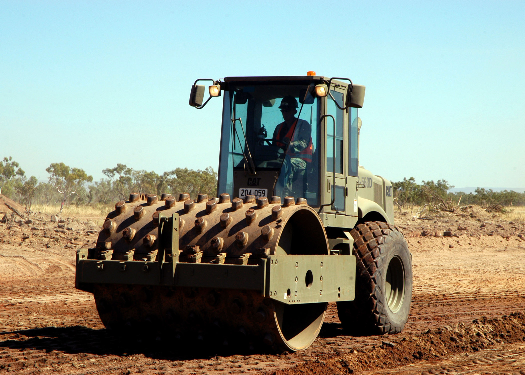
Seabees compactor roller.jpg
TIMBER CREEK, Australia (June 6, 2007) – Equipment Operator Constructionman Apprentice Jeremy K. Bak...
TIMBER CREEK, Australia (June 6, 2007) – Equipment Operator Constructionman Apprentice Jeremy K. Bak...
Search Openverse for Replacements
Presets:
Wikimedia Commons Category
This career has a corresponding Commons category: Category:Geotechnics
Review Commons category →Review Status
Last reviewed by reviewer on 2026-01-26T20:32:29.252882