cartographer
⏳ Unreviewed profession0
daily views
0 total
Cartography () is the study and practice of making and using maps. Combining science, aesthetics and technique, cartography builds on the premise that reality (or an imagined reality) can be modeled in ways that communicate spatial information effectively.
The fundamental objectives of traditional cartography are to:
Set the map's agenda and select traits of the object to be mapped. This is the concern of map editing. Traits may be physical, such as roads or land masses, or may be abstract, such as toponyms or political boundaries.
Represent the terrain of the mapped object on flat media. This is the concern of map projections.
Eliminate the mapped object's characteristics that are irrelevant to the map's purpose. This is the concern of generalization.
Reduce the complexity of the charact...
Current Images
Main article image

Add 19391 19-20.png
A Greek-language map of Hibernia (Ireland) and Albion (Great Britain) derived from Ptolemy's Geograp...
A Greek-language map of Hibernia (Ireland) and Albion (Great Britain) derived from Ptolemy's Geograp...

Bedolina roccia 1 foto rilievo.jpg
View of the Bedolina 1 rock and its tracing
View of the Bedolina 1 rock and its tracing

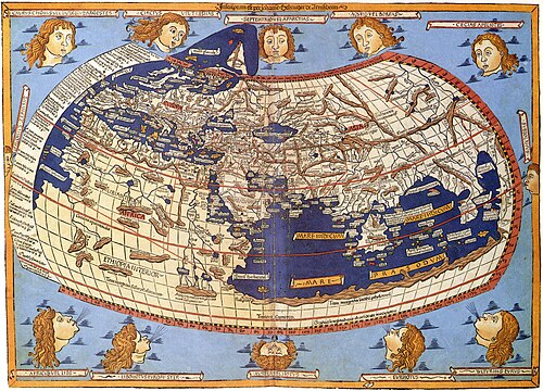
Claudius Ptolemy- The World.jpg
The world map from Leinhart Holle's 1482 edition of Nicolaus Germanus's emendations to Jacobus Angel...
The world map from Leinhart Holle's 1482 edition of Nicolaus Germanus's emendations to Jacobus Angel...

Easter Island map-en.svg
Detailed topographic map in English of Easter Island
Detailed topographic map in English of Easter Island
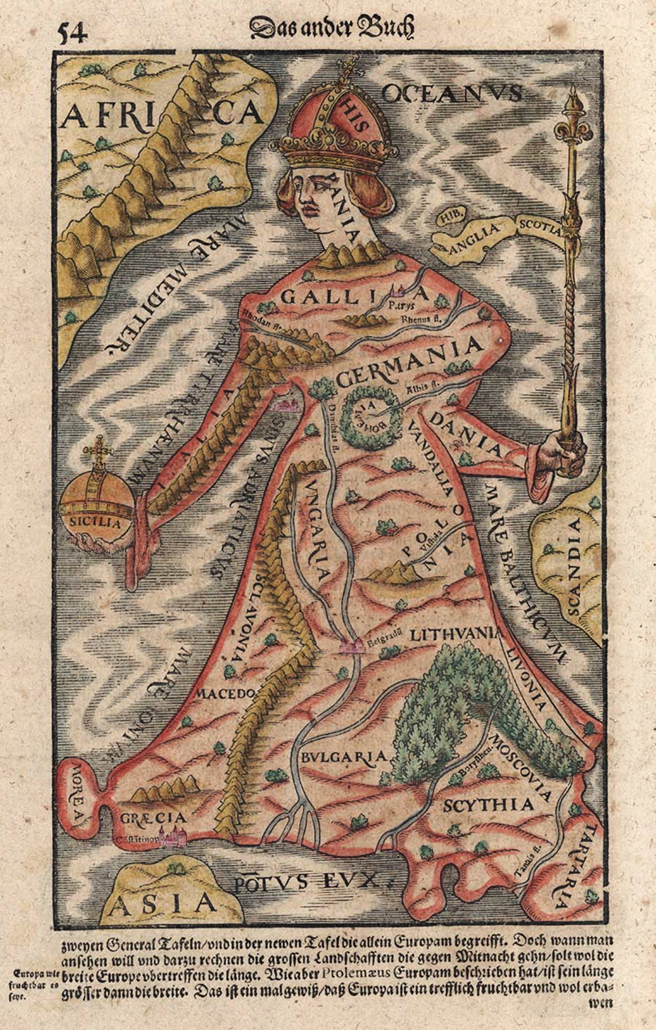
Europe As A Queen Sebastian Munster 1570.jpg
Map of Europe as a queen. In Sebastian Münster: Cosmographia, Das ist Beschreibung der ganzen Welt. ...
Map of Europe as a queen. In Sebastian Münster: Cosmographia, Das ist Beschreibung der ganzen Welt. ...

GIS Types.png
This figure shows the relationship between different types of GIS in the literature.
This figure shows the relationship between different types of GIS in the literature.

Livingston-Greenwich-map.jpg
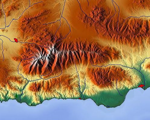
Maps-for-free Sierra Nevada.png
en:Sierra Nevada (Spain), physical map
en:Sierra Nevada (Spain), physical map

Nova totius Terrarum Orbis geographica ac hydrographica tabula (Hendrik Hondius) balanced.jpg
This is an image of Nova totius Terrarum Orbis geographica ac hydrographica tabula, a map of the wo...
This is an image of Nova totius Terrarum Orbis geographica ac hydrographica tabula, a map of the wo...

Orienteringskort bygholm 2005 detail.jpg
Orienteering map of "Bygholm Skov" just outside Horsens, Denmark. Map uploaded with permission from ...
Orienteering map of "Bygholm Skov" just outside Horsens, Denmark. Map uploaded with permission from ...
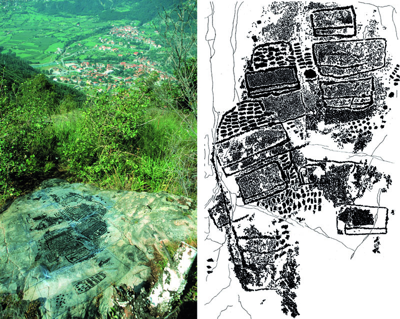
Paspardo roccia Vite29 rilievo foto.jpg
Camonica Valley rock art, the rock 29 of Paspardo, a large topographic composition engraved during t...
Camonica Valley rock art, the rock 29 of Paspardo, a large topographic composition engraved during t...
People icon.svg
People icon
People icon

Renaissance-styled-map-MAX-4K.jpg
A new and extensive geographical description of supernatural phenomena in German and Polish Pomerani...
A new and extensive geographical description of supernatural phenomena in German and Polish Pomerani...
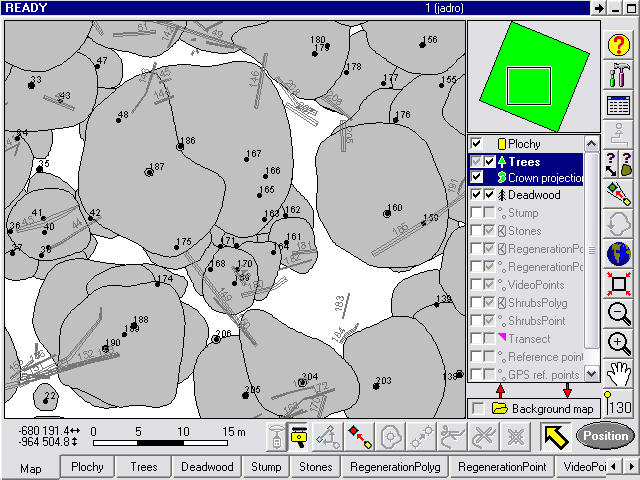
Structureforet.jpg
visualisation of forest structure (by Field-Map[1] technology).
visualisation of forest structure (by Field-Map[1] technology).
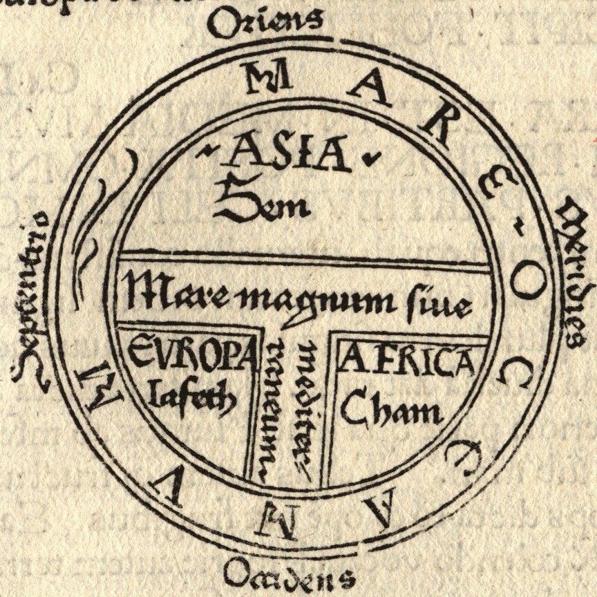
T and O map Guntherus Ziner 1472.jpg
T and O style mappa mundi (map of the known world) from the first printed version of Isidorus' Etym...
T and O style mappa mundi (map of the known world) from the first printed version of Isidorus' Etym...

Tabula Rogeriana 1929 copy by Konrad Miller.jpg
Reconstitution of the map Tabula Rogeriana by arab geographer Al Idrisi, by German cartographer Konr...
Reconstitution of the map Tabula Rogeriana by arab geographer Al Idrisi, by German cartographer Konr...

The Cartographic Process.png
This image shows each step of the cartographic process and how it defines the relationship between t...
This image shows each step of the cartographic process and how it defines the relationship between t...
Worlds animate.gif
A relation between the Mercator projection and the actual relative size of each country.
A relation between the Mercator projection and the actual relative size of each country.
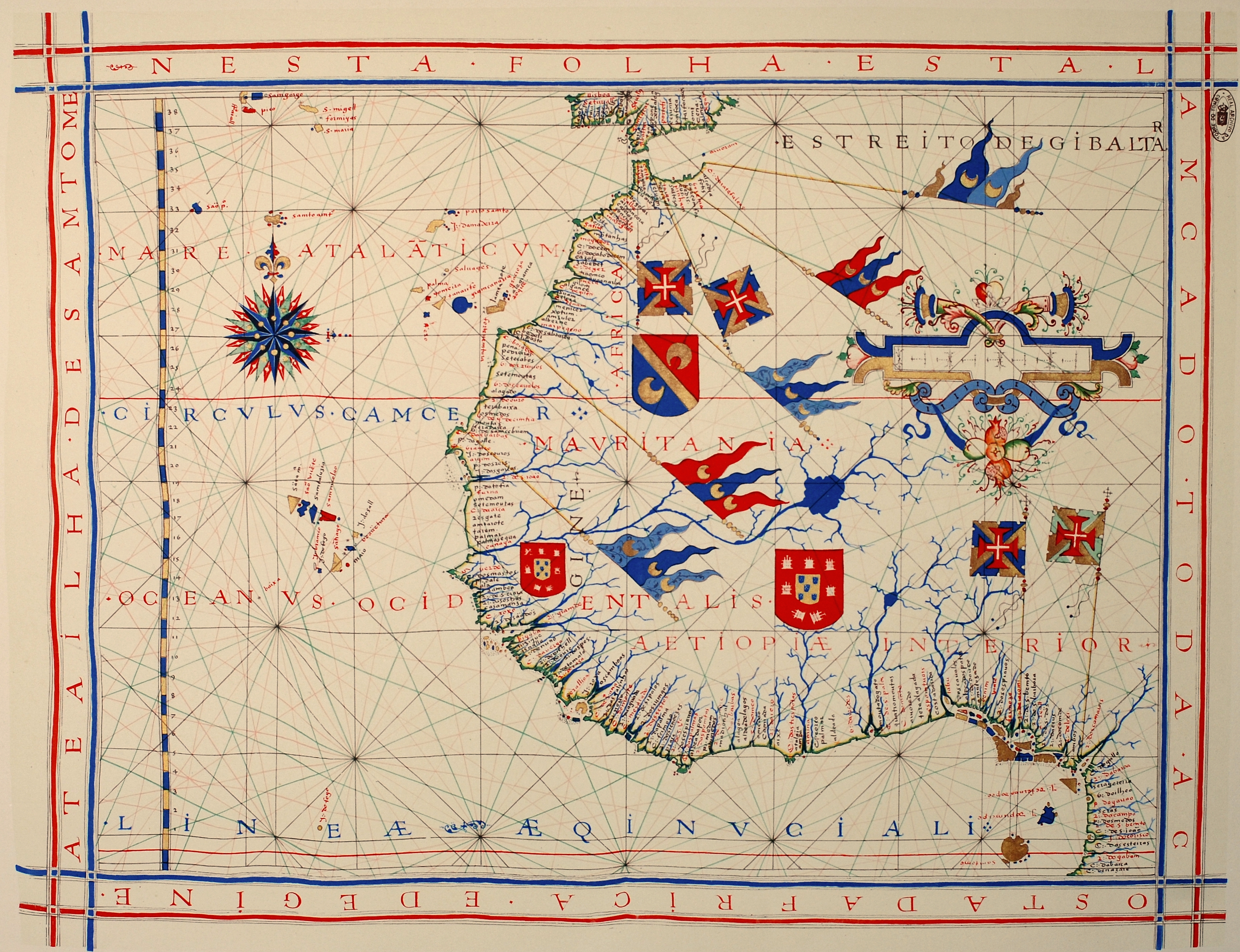
Fernão Vaz Dourado 1571-1.jpg
Nautical chart of Portuguese cartographer Fernão Vaz Dourado (c. 1520 - c. 1580), part of a nautical...
Nautical chart of Portuguese cartographer Fernão Vaz Dourado (c. 1520 - c. 1580), part of a nautical...
Search Openverse for Replacements
Presets:
Wikimedia Commons Category
This career has a corresponding Commons category: Category:Cartographers
Review Commons category →