surveyor
⏳ Unreviewed profession0
daily views
0 total
Surveying or land surveying is the technique, profession, art, and science of determining the terrestrial positions of points based on the distances and angles between them. These points are usually on the surface of the Earth, and they are often used to establish maps and boundaries for ownership, locations, such as the designated positions of structural components for construction or the surface location of subsurface features, or other purposes required by government or civil law, such as property sales.
A professional in land surveying is called a land surveyor.
Surveyors work with elements of geodesy, geometry, trigonometry, regression analysis, physics, engineering, metrology, programming languages, and the law. They use equipment, such as total stations, robotic total stations, theo...
Current Images

Main article image

-BLMcareers (21678771368) crop.jpg
The Bureau of Land Management has a unique mission within the Department of the Interior. It's the s...
The Bureau of Land Management has a unique mission within the Department of the Interior. It's the s...
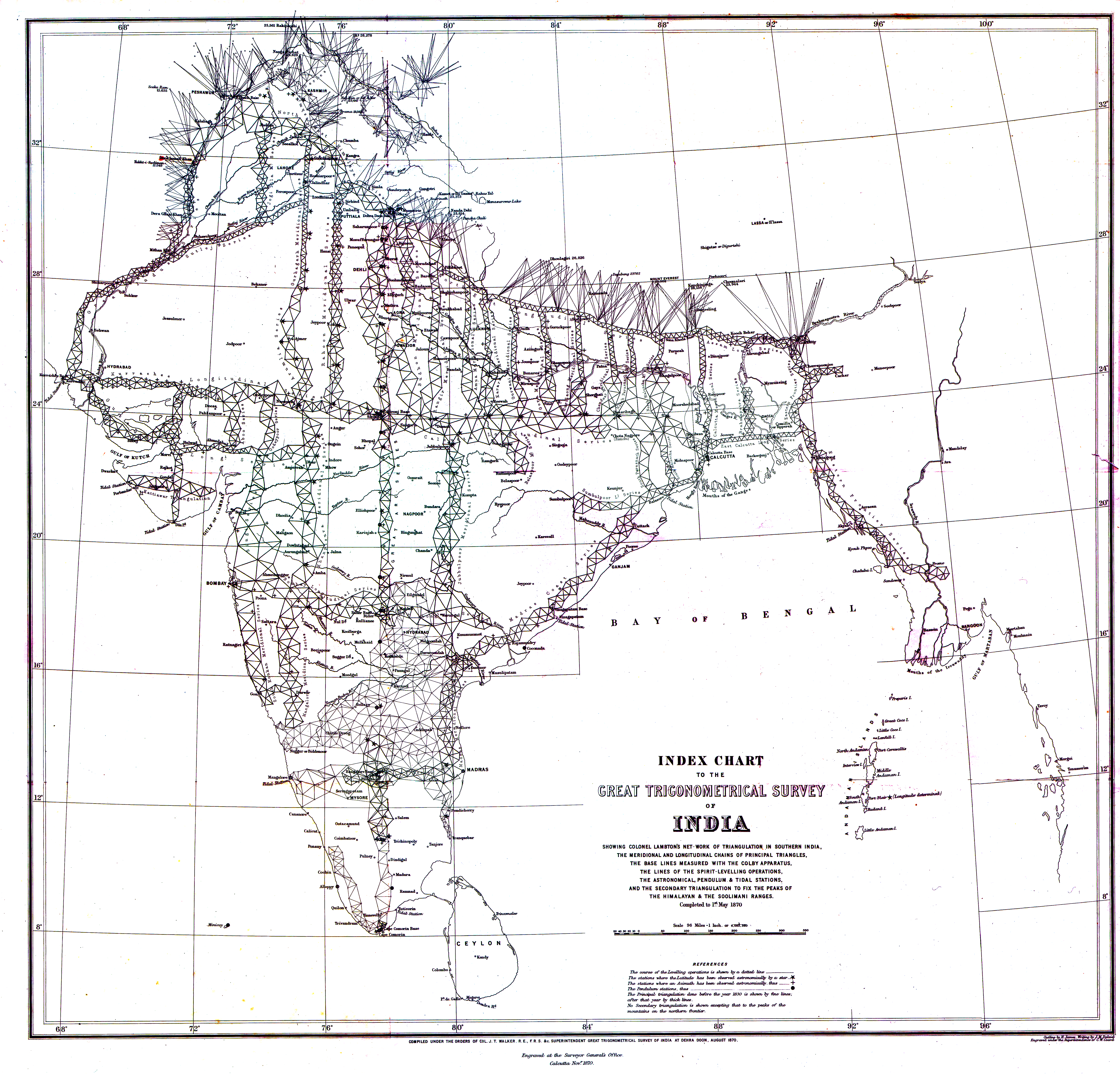
1870 Index Chart to GTS India-1.jpg
1870 Index Chart of the Great Trigonometric Survey of India
1870 Index Chart of the Great Trigonometric Survey of India

A student using a Theodolite in field.jpg
A student using a Theodolite in field
A student using a Theodolite in field

All female survey crew - Minidoka Project, Idaho 1918.jpg
All female survey crew - Minidoka Project, Idaho 1918.
All female survey crew - Minidoka Project, Idaho 1918.

Brunton.JPG
A Brunton Pocket Transit, a specialized compass used by geologists and other field-based surveying o...
A Brunton Pocket Transit, a specialized compass used by geologists and other field-based surveying o...

Camp of surverying party at Russel's Tank, Arizona, on eastern slope of Laja Range, 1,271 miles from Missouri River. (Boston Public Library) (cropped).jpg
File name: 10_08_000088 Title: Camp of surverying party at Russel's Tank, Arizona, on eastern slope ...
File name: 10_08_000088 Title: Camp of surverying party at Russel's Tank, Arizona, on eastern slope ...

Cc&j-fig23--plumb rule.png
This image has been extracted from another file
This image has been extracted from another file
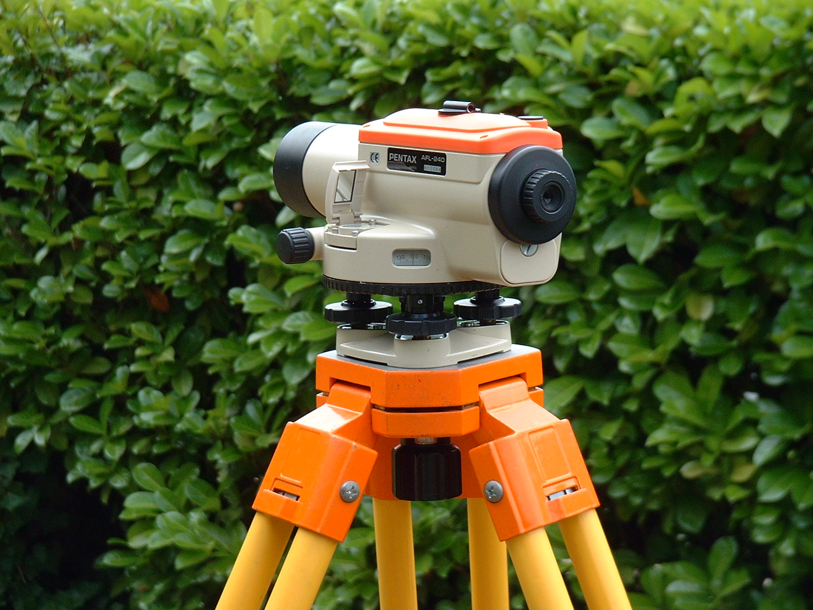
DumpyLevel.jpg
Optical level on tripod.
Optical level on tripod.

Field-Map birdie.jpg
Field-Map : Example of hardware equipment for forest inventories: GPS and laser rangefinder for mapp...
Field-Map : Example of hardware equipment for forest inventories: GPS and laser rangefinder for mapp...

GPS Survey Equipment at Weir Dyke Bridge - geograph.org.uk - 336908.jpg
GPS Survey Equipment at Weir Dyke Bridge. Photo taken at Weir Dyke bridge 172000. The gear belonged ...
GPS Survey Equipment at Weir Dyke Bridge. Photo taken at Weir Dyke bridge 172000. The gear belonged ...
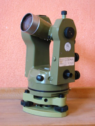
Kern Theodolit DKM2-A.jpg
Theodolit K1-S or K1-M von Kern-Aarau
Theodolit K1-S or K1-M von Kern-Aarau

NainSingh.gif
Cartographer Nain Singh
Cartographer Nain Singh

Table of Surveying, Cyclopaedia, Volume 2.jpg

Tide station leveling.jpg
Center for Operational Oceanographic Products and Services staff member conducts tide station leveli...
Center for Operational Oceanographic Products and Services staff member conducts tide station leveli...
Tkkstudentsbackinthedays.jpg
TKK surveying students with professor
TKK surveying students with professor
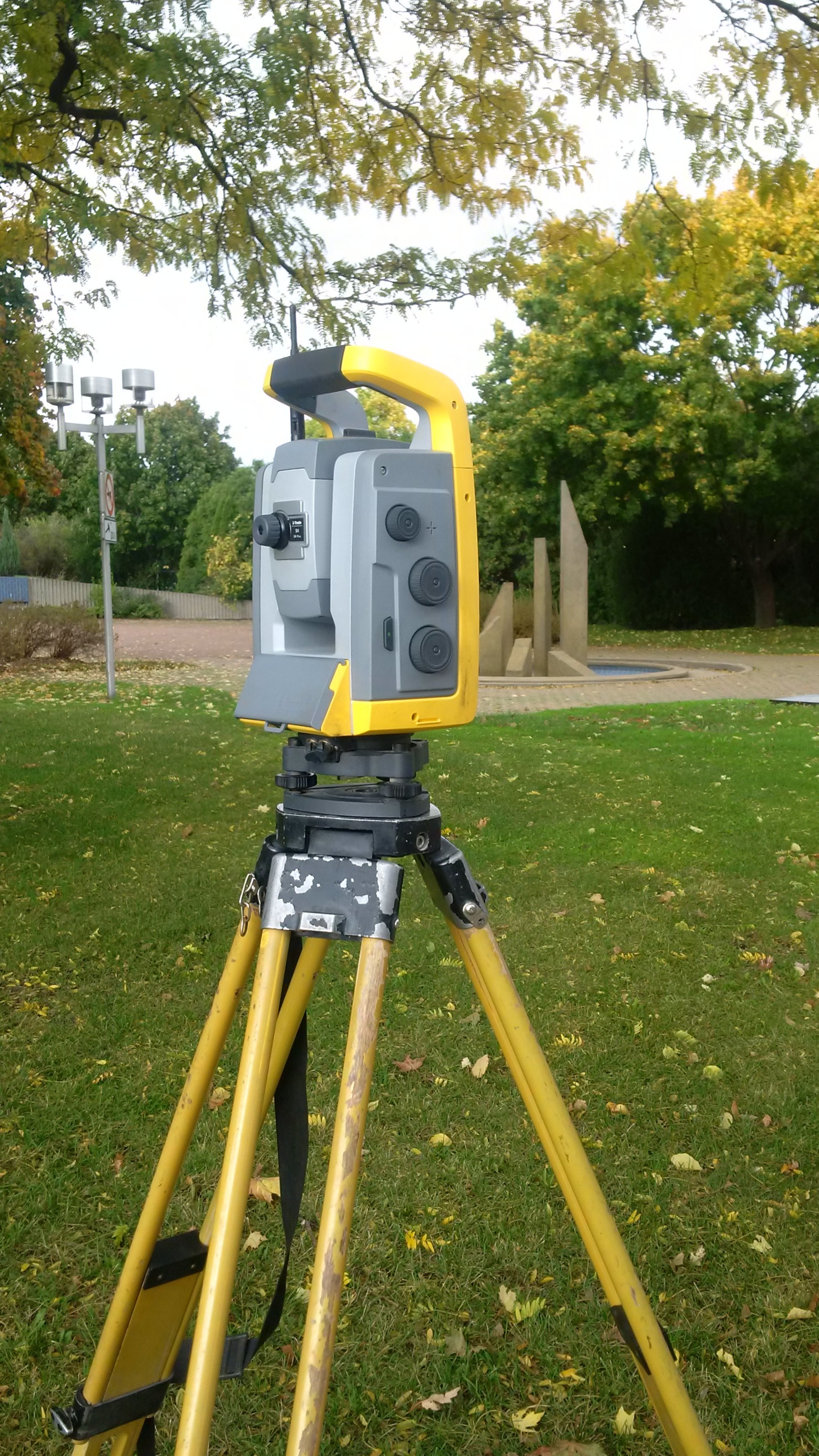
Total-Robotic-Station.jpg
Robotic total station on tripod.
Robotic total station on tripod.
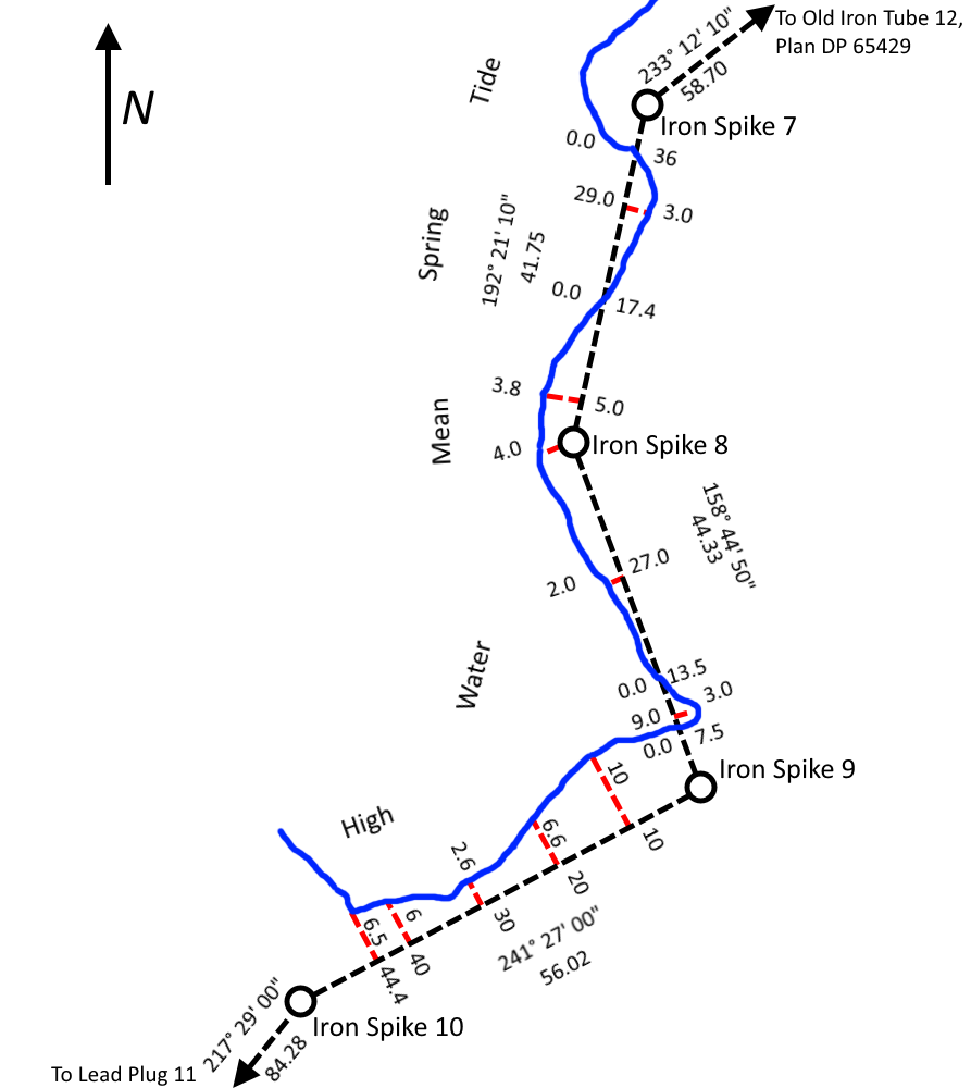
Traversing and Offsetting DP 79152.png
A simplified tracing of part of North Auckland Deposited Plan 79152 showing survey reference markers...
A simplified tracing of part of North Auckland Deposited Plan 79152 showing survey reference markers...
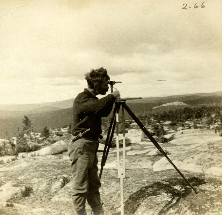
William Francis Ganong surveying Chiefs Mountain.jpg
William Francis Ganong surveying. Chiefs Mountain, Northumberland County, New Brunswick
William Francis Ganong surveying. Chiefs Mountain, Northumberland County, New Brunswick
Search Openverse for Replacements
Presets:
Wikimedia Commons Category
This career has a corresponding Commons category: Category:Surveyors
Review Commons category →